
July, 2018
Hazelton, Wyo. – Hazelton Peak is in Wyoming’s Big Horn Mountains near Powder River Pass. There are two other named peaks in this group: Hazleton Pyramid and Hesse Mountain.
“Why does everyone want to climb Hazleton Peak,” the Mayor of Caribou groused at me. “There was another guy who came out here last year and climbed it too.”
Caribou is a campground, and the Mayor is self-appointed. He’s a colorful old fellow who was grandfathered or had a grandfather, or is a grandfather? He didn’t trouble his speech with antecedents and rattled along with unanchored pronouns. It was real hard to follow his ideas, but none-the-less we had a friendly exchange on the roadside.
He managed to wrangle a claim from the Bureau of Land Management to mine something. To the chagrin of the Forest Service, he could camp on his claim all summer; every summer. Those folks want you to move along after two weeks at a site.
He’s a mountain man of modern sorts. He lived in a little camp and had a firewood lease or some semi-legal way of making a meager exploitation of the forest. His advocation appeared to be jacking with the Forest Service. He didn’t want me taking photos of his camp, and he remained certain that I was a spy from that service who was there to find him guilty of something, so they could revoke his claim.
Actually, the mayor’s question was a pretty good one. As The Rocky Mountains go, the Hazleton group is kind of squatty. Class II, walk-ups. Only about 10,200 feet. But still very formidable.
Why climb it? Not because it’s there, but because no one else does. Not to be argumentative with his honor, but one climber a year is not everybody.
Climbing the well worn trials of Colorado’s 14er’s are a test of stamina, endurance and conditioning. Remote mountains like the Hazleton group the challenge is in pathfinding.
Meaningful trail logs are scarce because there are no trails. I couldn’t find reliable advice even on which side to approach the mountain, and spent a day surveying it with a spotter’s scope on three sides from Park Service Roads. Poison Creek Road, through the Mayor’s jurisdiction, offered the closest and most promising access.
To approach from the south or west will take overnight backpacking. The north face is sheer vertical. It will require ropes and skills I don’t possess.
It doesn’t matter which face I approach, it is going to be a total bushwhack job through 2,500 feet of elevation gain in heavy timber.
The little critters want to steal your food, and the bigger ones want you to be food.
I climbed Hesse four years ago and the Pyramid two years ago. Both were very challenging. Hesse Mountain, I discovered, is where Heaven stores its extra thrones, and if you make its summit, you get to sit on one for a little while.
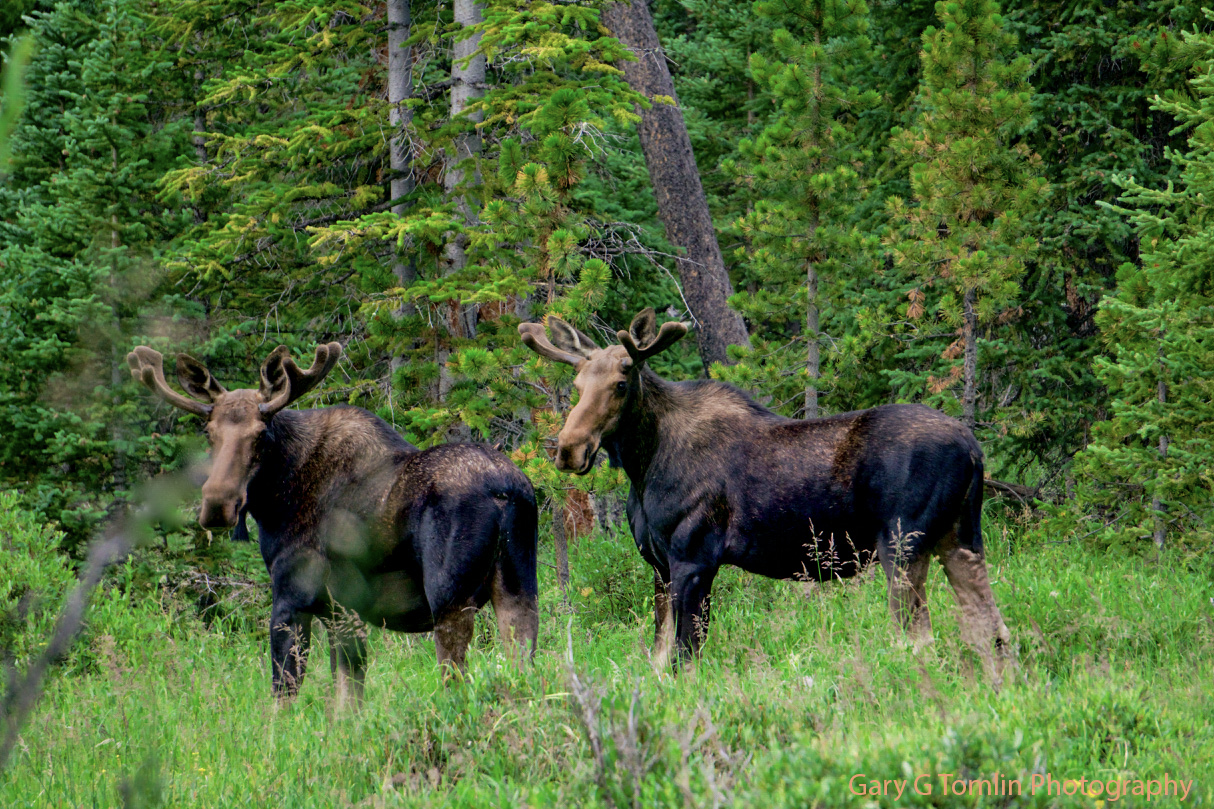
The moose have been real consistent. I’ve always seen several on every visit to this mountain group. I got into a pissing match with a big old bull in the trailhead parking lot when I came down from The Pyramid.
All I wanted was for him to look at my camera, but he wouldn’t do it. Made me mad, so I offered to ram him with my car. He treated me like an annoying bug and ignored me as he moved on about his business. Got a great shot of his butt.
When the rut comes in the fall these handsome boys will have full racks and not be getting along with each other so well. Perhaps a hunter will shoot them, and they won’t be getting along at all.

I understand the game management aspect of hunting, but the seasons are set during the rut when the antler sets are at their full capacity to make great trophies, and the bulls are distracted by overwhelming mating season hormones.Their defenses are down. It’s so heartless. In the reproductive matter of getting laid, it seems there should be more inter-species brotherhood.
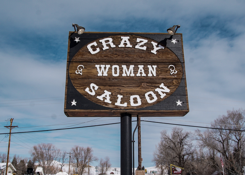
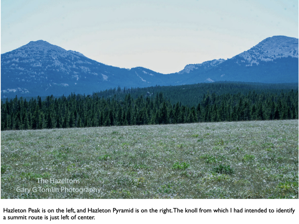
My approach will be up the middle fork of Crazy Woman Creek to its source. (There’s a story in this name, and of course, a man to blame.)
The Peak is on the left and the Pyramid on the right. The knoll in the middle separates the drainages and forms the source of the creek.
The contours on the topo map showed a steady Class I slope all the way up the knoll. From that vantage, I can scope out a summit route when I get there.
Coming down always looks much different and the objective is not so well defined. It’s good practice to frequently turn around and look behind you while going up, to preview what the landmarks will look like on the decent.
Coming down, I will intersect with the creek, and follow it downstream until I get back to the road.
The east face indicates a beautiful ridge line route to the summit. There is a scree field from the summit that drops about 500 feet and promises great speed and jacked-up thrill on the descent.
Coming down a scree field you are pitched forward, and it is kind of like walking down an escalator that is going down. Except rather than walking on moving, uniform steps, you are surfing on brick-sized shards of loose, sliding granite. Experienced climbers discourage this practice, the same way Baptists discourage drinking. (Do as I say’, . . .)
The battle is in the undergrowth. Those little green upright sticks in the distance are a standing army of close-knit, 100-foot-tall, pine trees guarding the summit like a fortress wall. At their roots are legions of annoying, infantry-like shrubs that are anxious to stick you with their spears. The challenge is finding a way through the thicket to get to the timberline, and that’s why reading the drainages correctly is so important.
Mountains this size can be brutally challenging and immensely satisfying, and a climb in this group is a great way to start an expedition. That is why I keep coming back. Bigger mountains in the Wind River Range are next on my itinerary.
There is no easy mountain. I think often of a kernel of wisdom “Climber,” magazine offered readers. “The Mountain gives a pass to those whom it chooses.”
Willpower does not serve you. In fact it can be an enemy. There are several factors outside of the climber’s control that can stop a climb. Wind, rain, snow, and ice, dependent on severity, can often be overcome. The mountain refusing a pass is an insurmountable obstacle. Willpower, in such a case, can get you hurt.
I could get a better look at the east face ridge route and make my approach decision from Poison Creek Road. A ridge line can offer a sweet mountain-goat trail or be sawtoothed, and there’s no walking on the latter.
I parked next to a 100-foot monolith aptly named Chimney Rock, and I could see the beginning of the ridge line to the summit. I grabbed my stick and headed into the woods to assess the ridge and bushwhacking challenge.
Almost instantly, I got lost like the Hobbit Bilbo and the party of dwarfs in Mirkwood Forest. The forest turned me around, and confused me as if it had cast a spell. Reasoning was no longer a reliable tool. What I thought was south was no longer south, and I wasn’t so sure about up.
The terror filled moment went like this: I don’t have my backpack and survival gear! “Don’t panic.” Or my jacket! “Don’t Panic!” Or water and food! “DON’T PANIC.”
Common Sense started telling me, “assess what you do have.” A compass – the single most essential thing in the wilds. Hiking stick – the vital tool for bushwhacking. A sheath knife – just the way you dress up here.
There were two distinct landmarks to look for: the peak itself, and the Chimney Rock. There were two hours of day light and creeks. Water will be no chore. I can build a John Meir shelter out of pine boughs and get through the night. I even had some toilet paper folded in my pocket. I relaxed.
OK, start climbing until I get high enough to see either the peak or the chimney rock and orientate from there. Indeed, that’s how it played out.
When I got sight of the peak, I knew my location, the compass lead me out. I could also see that the ridge line was a no-go.
I found a dry drainage and followed it until I came to the road. I was about a half-mile from the chimney rock. All this took an anxiety-filled hour.
I had enough daylight to set a comfortable camp. I got everything ready for a quick breakfast and to start my summit bid soon after daylight.
It was deeply humbling to misplace my car so easily, and it concerned me into the night. Was this short, obscure, Hazleton Peak telling me, “No pass?” Perhaps the Mayor has more local influence than I realized.
It was a sunny July morning. All was a go.
Bounced across the expansive meadow that led to the forest in good order and form, but it turned into torture as soon as I reached the timber. Nearly every step was a negotiation with the under growth. It took four hours to reach the top of the knoll and I was wiped out. I had expected to be well past the timber line by this time, and it will be at least another two hours of battle to reach it. I could probably make it to the summit, but I wouldn’t have any strength or energy left for coming down which was going to be harder than going up.
I was disappointed with myself, but the number one objective of this sport is to get home safely, and an important skill is knowing when to quit.
Since I don’t have a summit photo to share, please enjoy these gray jays in Caribou Campground, and be grateful you don’t have to scrape charred barbecue sauce, off of a grill, with your beak, for subsistence.
# 30 #
5 responses to “The Hazelton Group”
What a great adventure. Kind of scary but I’m sure it was all worth it. Thank you for sharing.
Tough couple of days huh? Thanks for the article that reminds me I’m glad I’m in my recliner. I enjoy reading of your adventures. Keep on and always include me as one of your grateful readers. Love you, Aunt Pat.
This is such a great read. I almost felt like I was elevating my hiking experience by just reading it!
Thanks for including me, brother, in your readership. I certainly am not qualified to critique your writing. I had never even heard of an unankered pronoun , but I know one when I hear one. HOWEVER, I remember being humiliated by a Navy Chief Petty Officer for using “orientate” in referencing the orientation or orienting of a field map.
I did check the dictionary on my phone and, sure enough, it is in there with a vague reference to British usage.
I am writing to you from Little Gasparilla Island. We’re here for the month of February. It was hit by 2 hurricanes last year and is still recovering.
Oh my Dear Big Brother, I have so much to say to this that it will probably become a blog post about my sojourn into the Realm of Grammar.
I suppose, given the circumstances and times, your Chief Petty Officer can be forgiven for obsessing about the East. And there was no wisdom in disputing him.
However, he clearly didn’t know the difference between a noun and a verb.
Your usage was correct. Don’t let Grammarians suck the life out of our language.
Glad to hear your wintering in Florida, and so close to Bokeelia.
gt